Mount Baldy Is Dangerous Even for Experienced Hikers. Can Money and Tech Save Them?
Federal funding is helping upgrade search-and-rescue aircraft, and drones are helping crews find stranded climbers, but a looming “Super El Niño” raises the stakes this winter.

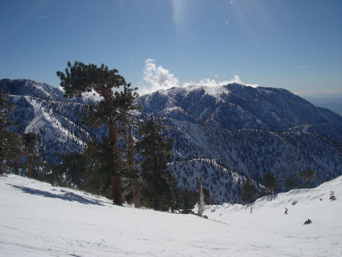
Summit Mount Baldy in winter and count on finding dense fog, howling wind gusts or flurries spiraling into snow devils. Any of these conditions can limit visibility on the 10,064-foot mountain that straddles San Bernardino and Los Angeles counties.
The one time Tim Davis climbed the mountain in winter, the view was unusually clear. The trail back down, though, was buried. Davis still remembers the anxiety that flooded him during that descent a decade ago.
"We couldn't see the trail because it was completely covered with snow,” he said. “We were off the trail for a while. It was a pretty steep angle, and we had crampons on, but we didn't have ice axes, so we were not the best prepared.”
Using sticks, he and a friend cut their own path. Davis is an Ironman triathlete who has twice climbed Mount Whitney, the highest peak in the lower 48 states. Yet he feared the worst. What if he slipped and left his three children fatherless?
“I didn't want to die,” he said.
After an hour, the Baldy Bowl Trail emerged. Davis has since climbed the mountain multiple times, including this past summer, but has sworn off Mount Baldy during winter: “That was too scary for me.”
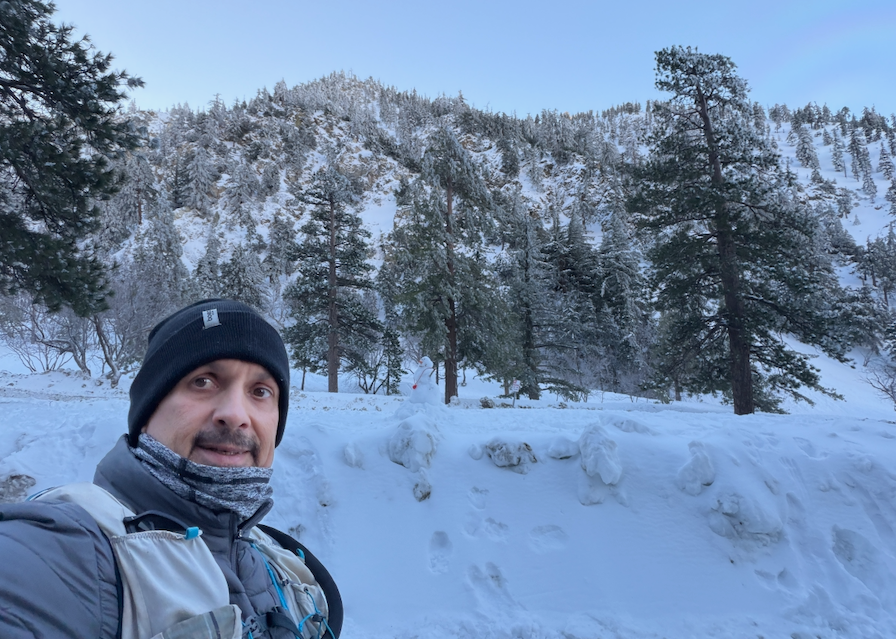
What forecasters are calling a “Super El Niño” may make Mount Baldy especially treacherous this coming winter by packing it with even more snow and ice. Officials, however, have made some progress since last December, when the deaths of three men who fell from the Devil's Backbone Trail sparked a wave of concern. Two months ago, Rep. Judy Chu, D-Calif., secured more than $1 million in federal funding to help offset the $36 million the San Bernardino County Sheriff's Department has spent upgrading its aviation fleet to better conduct search-and-rescue operations. Drone technology is locating hikers in trouble, while calls continue for more trail signage to prevent accidents.
Mount Baldy poses risks to hikers all year, but particularly in the colder months, when weather can change dramatically from the base of the mountain to its peak — the highest in L.A. County. Snow can wipe out trails, and freeze-thaw cycles can loosen rock into unstable debris known as scree. A lack of preparation or experience just adds to the dangers.
Even veteran alpinists have perished on Baldy. The actor Julian Sands was one of 23 people who died there from 2016 to 2025, and he had scaled some of the world's highest peaks — Aconcagua, Mont Blanc and Mount Kilimanjaro. His January 2023 death after hiking the Baldy Bowl Trail, also known as the Ski Hut Trail, made global headlines. So did the December 2025 deaths. Eight months afterward, those fatalities prompted a concerned citizen to make unauthorized repairs to the Devil’s Backbone, only to face backlash from hikers for potentially making the trail more hazardous.
Experts stress that the best safety measures are those hikers can take themselves, such as carrying the right gear, ensuring they are fit enough for the trek and retreating if conditions put them at risk.
“It’s not really a training mountain,” said Eric Vetere, commander of the all-volunteer West Valley Search and Rescue, which operates under the authority of the San Bernardino County Sheriff’s Department. “It's not a mountain to go practice on to get better, especially in the wintertime.”
Why Even Experienced Hikers Get Killed on Mount Baldy
Since joining West Valley Search and Rescue in 2019, Vetere has climbed Mount Baldy hundreds of times. On average, he said, volunteers spend up to 40 hours per month training on the mountain. But as familiar as he is with Baldy, even Vetere feels uneasy on occasion.
“There's many times that I'm like, ‘Why am I up here?'” he said. He never forgets the peak’s perils, especially after the loss of volunteer Timothy Staples, who died seven years ago during a search-and-rescue mission.
"We're all humans too, and we're leaving our families to go into very dangerous situations,” Vetere said. “The challenges and the risks are just as dangerous for us."
Hikers who slip on other snowy mountains might tumble onto relatively flat terrain, he said. Mount Baldy is different: Its steep angles can lead to 500-foot falls.
“In many areas if you are not properly trained and equipped and you lose your footing and you start to fall and slide, it's very hard, if not sometimes impossible, to stop yourself,” Vetere said.
Mount Baldy is formally named Mount San Antonio after Anthony of Padua, the patron saint of travelers and the lost. The Tongva people called it Joāt, or “the snowy mountain.” Its nickname, Baldy, stems from its broad and treeless summit.
The mountain’s varied terrain can lull hikers into a false sense of security.
"It's very easy to go from the fire road at Falls Gate, where most people start their hikes, to a condition where you're on a very narrow, thin trail and the risk factor of a slip and fall and slide goes up,” Vetere said. “Commonly folks don't see it, pay attention to it or respond to it appropriately."
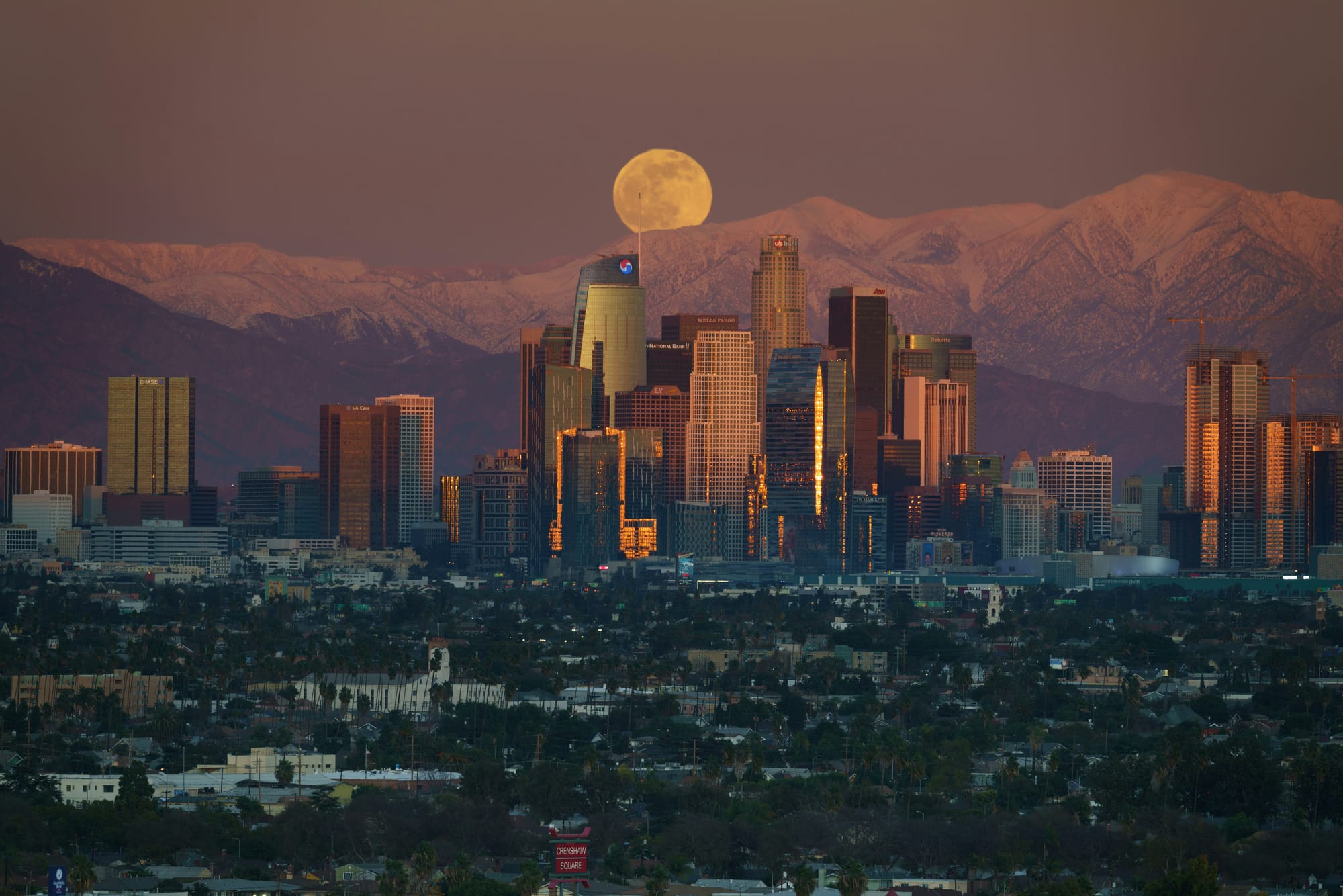
Amalie Jo Orme, a professor of geography and environmental studies at California State University, Northridge (CSUN), said that many hikers underestimate Mount Baldy because it sits just 45 miles east of Los Angeles.
“It's not the Eastern Sierra, it's not the Rocky Mountains, and I think they make an assumption that everything will be fine because you can see the city below,” she said.
The weather in the Los Angeles basin differs from the weather on Mount Baldy, which can shift significantly during the course of a hike.
"You have to know, in a sense, the longitudinal look of how the weather is developing over a day, bearing in mind that to do the entire 11-mile loop, it's about six to eight hours,” Orme said.
Mount Baldy’s steep southern and western faces lead to orographic uplift — air pushing up against the mountain front, causing rapid cooling.
“And depending on the season and the kind of moisture content in the atmosphere, you can easily get thunderstorms because orographic uplift produces very rapid changes in temperature, which can generate the large billowing clouds,” she said.
Hikers may begin their treks in warm, pleasant weather, only to reach the peak and experience temperature drops of 30 degrees. Summer tends to bring intense rain and lightning, while winter ushers in heavy snowfall that can erase trails, as Davis experienced.
"The people who go up there in the winter should be experienced on ice,” Orme said. “Because we live in a temperate climate, we will get snowpack, but we then have warm days and snow will melt, and then it refreezes at night. And these freeze-thaw cycles are what produces the scree, but also freeze-thaw produces areas of ice."
Vetere emphasized how important it is that hikers carry the right gear — and know how it works.
"So many times we will come across hikers that have bought crampons and they've bought an ice axe, but they're still in their wrappers or they're hanging from their pack,” he said. “They're not familiar with using them, so it's not so much buying the equipment as it is knowing that you're in mountaineering conditions.”
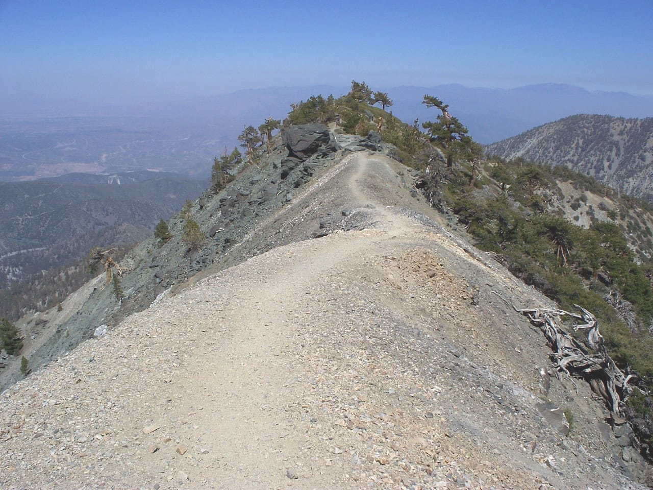
Following the three December 2025 deaths, including of a 19-year-old college student, the Devil’s Backbone Trail has drawn intense scrutiny. But both the Backbone and the Bowl present threats to hikers, Orme said.
"When you're going up the Devil's Backbone, you have an elevation gain there of over 2,300 feet, and the trail up there — you have a lot of loose debris because Mount Baldy, at least portions of it, are part of the granitic core of Southern California,” she said. “So walking on scree on a narrow pathway is challenging."
Asked if she would attempt the Devil’s Backbone Trail in wintertime, Orme answered: “Absolutely not.”
The Baldy Bowl Trail is no cakewalk either. She pointed out that climbers who choose that route must hike nearly a mile to the summit. On their way, they will come across multiple switchbacks — sharp zigzag paths across the trail.
Even so, Vetere noted that thousands of people climb Mount Baldy each week without incident. He described it as a well-traveled mountain where hikers can’t afford to get complacent.
“It is to be respected,” he said. “It's Mother Nature, and the storms and the weather and the ice are going to do what they’re going to do, and that's why it's on us as humans to take care of each other and make sure that we're messaging out the right things to do and when to avoid it and when to go enjoy it.”
Dollars, Drones and Safety Nets
Rep. Judy Chu will never forget looking down at Mount Baldy from the sky, she said. In September, she flew over the peak in a helicopter with officials from the San Bernardino County Sheriff's Department.
“It was really interesting to see, first of all, the very, very top of Mount Baldy and how narrow that trail is,” she said. “But what was also interesting was to see all the people up there.”
Hikers lingered near the base of the mountain’s waterfalls, where visitors are generally safe, she said. Mount Baldy’s chutes include the 75-foot San Antonio Falls, which spills over a slope of granite and shale on the main southern face. There’s also Stoddard Canyon Falls, a 40-foot cascade folded into a gorge near the foothills.
“But hikers inevitably want to go higher, and that's where the rescues have to happen,” Chu said.
The most sobering sight she took in that day was the cliff where Julian Sands died.
“There's a part right near the top where the trail is so narrow you could easily fall,” she said. “It's a cliff without any vegetation, so you just keep on falling.”
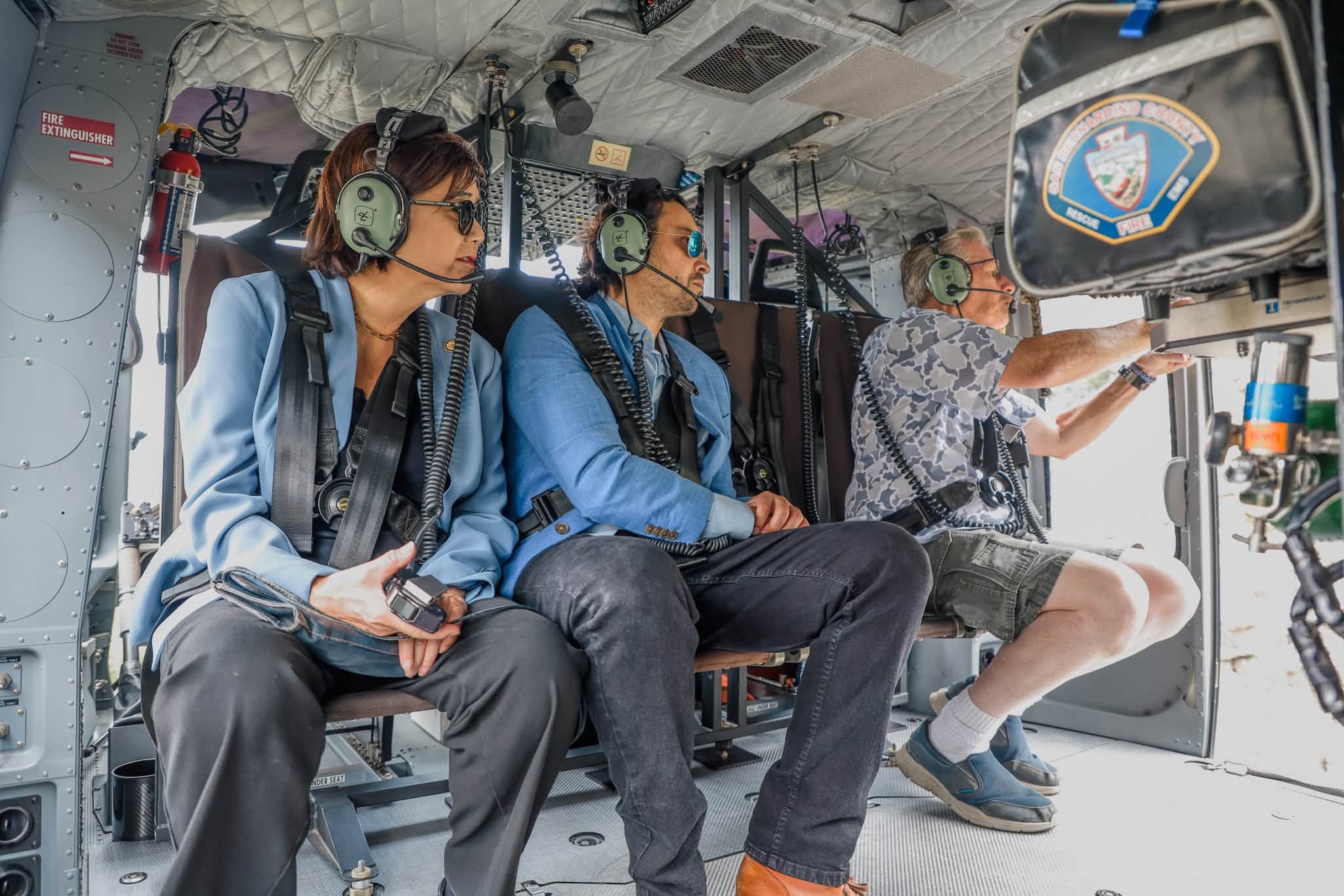
Since 2023, Chu has represented California’s 28th Congressional District, which encompasses Mount Baldy. Following Sands’ death that year, the congresswoman convened a roundtable discussion that included the San Bernardino County Sheriff’s Department and the U.S. Forest Service to improve hiker safety. The meeting led to more public messaging about weather risks, trailhead signage warning of danger and volunteer outreach, she said.
“There are times when it's obvious that the trail needs to be closed, like when the weather is very, very hazardous,” she continued. “But there hadn't been very good communication between the U.S. Forest Service and the sheriff. So what our roundtable did was to strengthen that communication, so that they have been able to close it in the most hazardous situations."
Chu described the Forest Service as chronically underfunded while emphasizing the great need for interventions at Mount Baldy. Multilingual signage, greater ranger patrols and trail clearance could prevent more accidents, she said.
Orme suggested that environmental and civic groups could close the gap by fundraising for additional signage and authorized trail repairs.
“There's parts of the Devil's Backbone that are perfectly passable for many people, but it's along the single walking areas where people get into trouble,” Orme said. “Yes, you could engineer it, but that would probably be an investment that is beyond the scope of the Forest Service."
Davis, the triathlete, would feel more secure hiking Devil’s Backbone if ropes or chains were bolted to the sides of the narrowest sections.
“One of the narrow sections kind of curves and goes up and over, but it's only like 10 or 20 feet long,” he said. “The other narrow section is a good 50-to-80 feet long.”
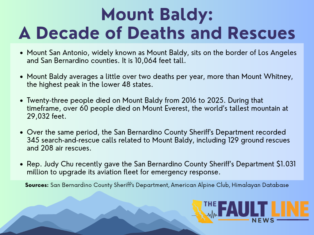
From 2016 to 2025, the San Bernardino County Sheriff's Department responded to 345 rescue calls, including 208 aerial and 129 ground rescues of Mount Baldy hikers. The mountain averaged just over two deaths annually during that period, a rate the department compared with fatalities on Mount Everest, where more than 60 people died over those years. Mount Whitney, part of the Sierra Nevada range, averages just under a fatality each year, according to the American Alpine Club. Of course, Baldy’s death count is inflated by the high traffic it gets, given its accessibility to millions of people in one of the nation’s largest metropolitan areas.
In January, after the three Devil’s Backbone deaths, San Bernardino County Sheriff Shannon Dicus called for more resources to improve hiker safety.
“The frequency of rescues our department is involved in annually, and the lack of concern for what’s happening on Mt. Baldy by those who are responsible for maintaining visitors’ safety needs to be addressed,” he said in a statement. “For the last several years, our department has been trying to have the U.S Forest Service more involved in keeping people safe while they recreate on Mt. Baldy.”
The Forest Service did not respond to The Fault Line News’ repeated requests for comment about efforts to prioritize hiker welfare.
“We saw an increase in their involvement, especially ahead of storms last year, and are hopeful they continue to do their part to ensure safety of their land users and hikers,” Vetere said.
Moreover, Chu presented the Sheriff’s Department with over $1 million on Sept. 8, the same day as her aerial tour.
The funding falls short of the cost of a new search-and-rescue helicopter, Chu acknowledged, but the agency can direct the monies to aviation fleet upgrades. She said the department’s helicopters are aging and need replacing. “They are working in very unusual places where the space to land is very narrow,” she said. Crews often lower first responders into dangerous spots, such as crevices around waterfalls, and need “that extra maneuverability.”
But when high winds, thick clouds or severe storms roll in, helicopters are grounded. Search-and-rescue volunteers have to travel on foot to find lost hikers — missions that can take all day during violent weather.
“You're either coming in via helicopter or you're coming in via a very long hike,” Vetere said. “There’s really no in-between right now, so if we can’t get a helicopter in there to get to somebody, to hoist somebody, that person could be in that predicament for several hours before we even get to them.”
In fact, aerial rescues are rising. They hit 30 in 2025, tied for the decade high, while ground rescues fell to a decade low of 5. Drones are also helping, as they can fly into precarious sites like ice ponds or steep bowls without immediately endangering search-and-rescue volunteers.
“They're going out putting their lives on the line to help another person, and it says so much about their character," said Jenny L. Smith, a spokeswoman for the San Bernardino County Sheriff's Department.
Orme, director of CSUN’s Geomatics and Aerial Environmental Research Group, which flies drones, characterized them as the game changers of search and rescue.
“They use drones to do post-fire searching for hotspots and drones to find lost cattle, lost people,” she said. “Our students now work in places like police departments doing drone work, and certainly for county agencies and state agencies."
As technology assists with rescues, a debate persists about whether to require hikers to obtain permits to climb Mount Baldy. The Forest Service would oversee such a development. Climbers wouldn’t necessarily have to pay for permits, Chu said.
“It could be very accessible and not discourage people from going up there,” she said. “It could be a free self-issued permit. It could be a fee-based seasonal permit. There could be tying permits to educational requirements."
Unless the mountain sees an unusual surge in hikers, Orme doubts that permits will be required. Davis would oppose that change.
"I hate having to get permits to go into our public lands,” he said. “That's the only reason I haven't done Whitney more is because of the permit process. I've done Langley a lot more because you don't need a permit, and it's right beside Whitney."
With a permitting system, Chu said, the authorities would actually know who was on the mountain.
“Now they have no idea," she said.
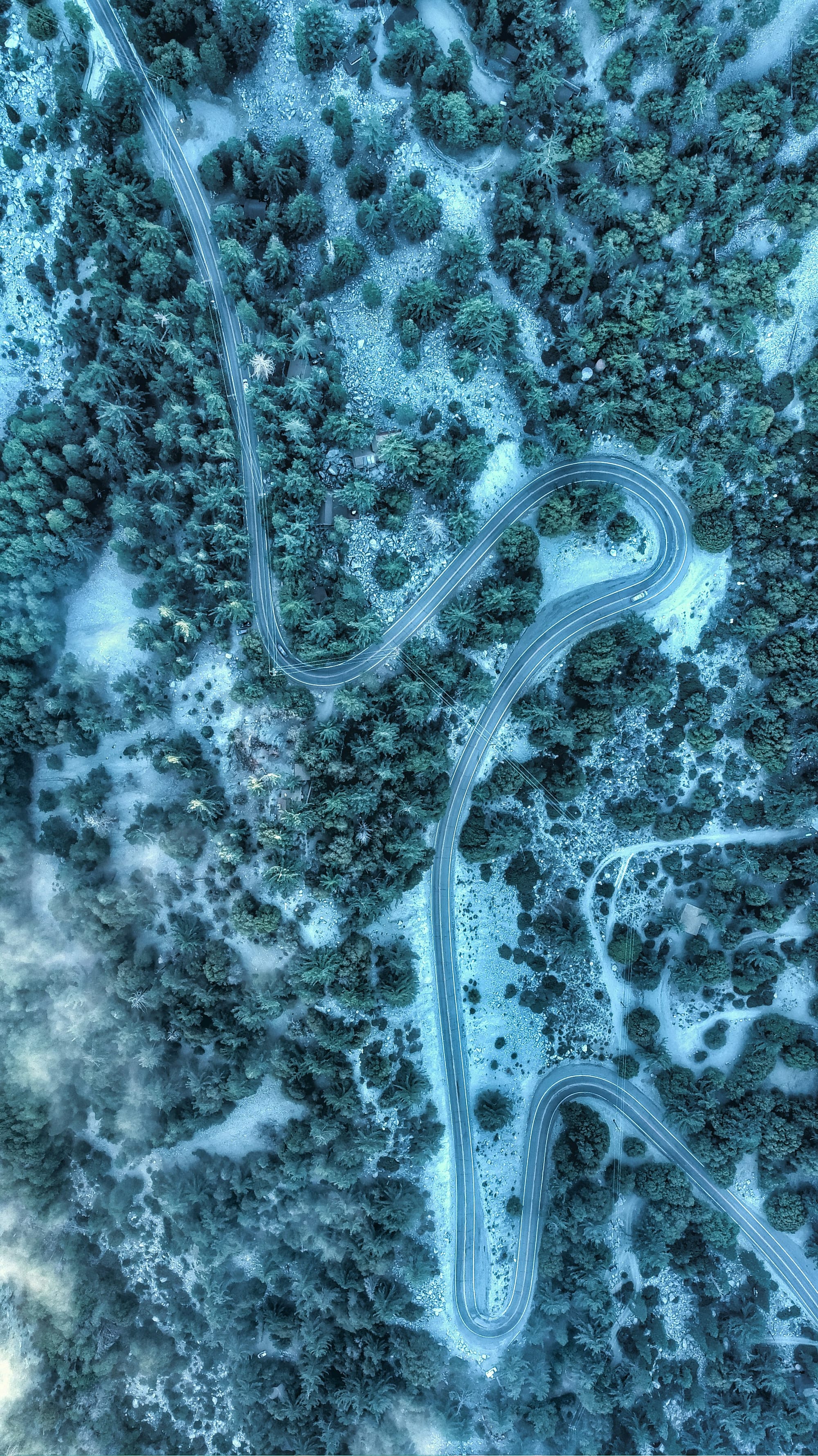
What Hikers Can Do — and When to Turn Around
In California, El Niño is already pounding the coastline, raising sea levels and imperiling beachfront properties. It’s unclear how the climate phenomenon, distinguished by higher than normal surface temperatures in the Pacific Ocean, will affect inland areas like Mount Baldy, but it could lead to extreme downpours.
Orme noted that the Super El Niño events of the 1982-83 and 1997-98 winters led to extraordinary precipitation in the San Gabriel Mountains, with Mount Baldy Resort slammed by over 350 inches of snow. It averages 117 to 170 inches during a typical cold season.
“There's no guarantees, so we will wait and see,” Orme said. How hikers fare safetywise this winter "is just a question of geology, scree, weather and preparedness."
To avoid mishaps and losing their way, climbers should physically train for the hike and rely on low-tech tools such as maps and compasses to navigate the mountain rather than apps, Orme said.
Davis, for one, is accustomed to the physical demands of the mountain. He estimates that he’s climbed Mount Baldy dozens of times, including twice daily while training for ultra-marathons.
Over the summer, he joined his wife and teenage daughter on separate hikes up the mountain — their first outings to the summit. Neither is eager to repeat the climb, he laughed.
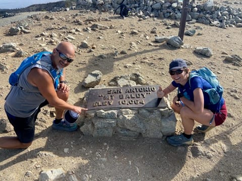
Davis, by contrast, keeps returning. He’s even found a way to visit safely during winter.
“I'll go right to where the Backbone starts and then turn back around, and that's still a good hike, but that's a very safe route," he said.
Search-and-rescue volunteers would like to see more people practice that kind of restraint. Climbers who explore alternative routes or heed their intuition could spare themselves from life-threatening ordeals.
“Once the hair on the back of your neck stands up and you look at each other and go, 'This is getting icy' — that's a real good time to go ahead and turn around,” Vetere said.
This article — produced by The Fault Line News — is available to republish for free. For republishing inquiries, please contact us.